


MOUNT AJDAHAK
Mount Ajdahak is one of Armenia’s most remarkable high-altitude hiking destinations. Rising to 3,597 meters above sea level, it is the highest peak of the Gegham Mountain Range. The mountain attracts hikers with its volcanic crater, crater lake, ancient petroglyphs, and panoramic views of the surrounding mountains and lakes.
A hike to Ajdahak offers an opportunity to discover Armenia’s distinctive volcanic landscapes, explore rock carvings dating back thousands of years, and experience the beauty of the country’s highlands.
Where Is Mount Ajdahak Located?
Mount Ajdahak is located in Armenia’s Gegham Mountain Range. At 3,597 meters above sea level, it is the highest summit of the range. Ajdahak is a volcanic cone shaped by geological processes over time.
The surrounding area features extensive high-altitude plateaus, volcanic terrain, rocky slopes, and alpine meadows. These natural characteristics make Ajdahak an appealing destination for hikers, nature enthusiasts, and geology lovers.
The Crater and Lake of Mount Ajdahak
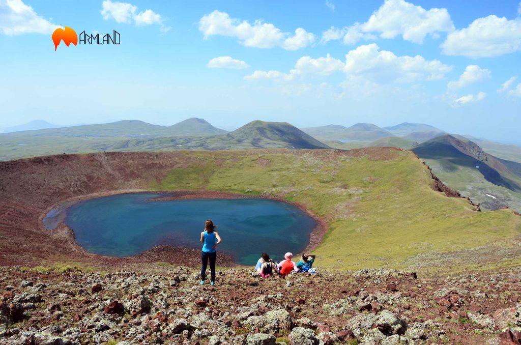
One of Ajdahak’s main natural attractions is the lake formed within its volcanic crater. The lake is particularly beautiful when the sky, clouds, and surrounding volcanic slopes are reflected on its surface.
Its color can appear to change depending on the lighting, weather, water conditions, and viewing angle. This makes Ajdahak’s crater lake especially appealing to photographers and travelers interested in high-altitude landscapes.
During colder periods, the lake may freeze partially or completely. Its appearance changes throughout the year, revealing different aspects of the mountain’s natural beauty.
The Petroglyphs of Ajdahak: A Window into Ancient History
The area surrounding Ajdahak is known for its ancient petroglyphs, which offer valuable insights into the lives, beliefs, and environment of the early inhabitants of the Armenian Highlands.
The rock carvings feature animals, human figures, and various symbolic motifs. Some are attributed by researchers to prehistoric periods, including the fifth and fourth millennia BCE. Together, these images form an important part of the region’s cultural heritage.
The petroglyphs give the Ajdahak area both natural and historical significance. Visitors should avoid touching, marking, or damaging the carved surfaces and help preserve this archaeological heritage for future generations.
Hiking Mount Ajdahak: Routes and Duration
Mount Ajdahak is one of Armenia’s well-known high-altitude hiking destinations. The choice of route depends on the starting point, weather conditions, road accessibility, and the group’s fitness and experience.
Under favorable conditions, the ascent and descent may take approximately 6–8 hours, depending on the chosen route and the group’s pace. This is a general estimate rather than a guaranteed hiking time.
During warmer months, certain access roads may be passable with suitable off-road vehicles. In winter, snow and changing road conditions may significantly restrict vehicle access. A winter ascent therefore requires advance route checks, careful weather assessment, and appropriate mountain experience.
Hikers should bring suitable trekking boots, weather-appropriate layers, sufficient water and food, and protection from sun and wind.]
Mount Karmirkatar: One of the Best Viewpoints Near Ajdahak
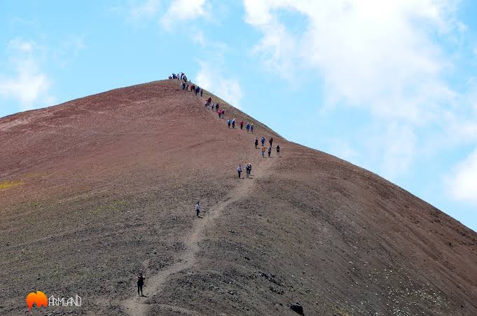
One of the interesting viewpoints in the Ajdahak area is the summit of Mount Karmirkatar, whose reddish tones stand out against the surrounding landscape.
Both Karmirkatar and Ajdahak are volcanic mountain formations, and their crater lakes add to the natural appeal of the region. In suitable visibility conditions, Karmirkatar offers views of the Ajdahak massif and the surrounding high-altitude landscape.
This viewpoint is especially appealing to travelers who want to appreciate Ajdahak not only from its summit but also as part of the wider mountain scenery.
What Can You See from the Summit of Ajdahak?
On a clear day, the summit of Ajdahak and nearby high points offer expansive views across Armenia’s mountainous landscape.
Depending on visibility and the chosen viewpoint, hikers may see Lake Sevan, Lake Akna, Lake Vank, and the mountains of Hatis, Ara, and Aragats.
These panoramic views make the ascent particularly memorable. Volcanic terrain, mountain lakes, and distant peaks reveal the natural diversity of the Gegham Mountain Range.
Discover Mount Ajdahak with ArmLand
Mount Ajdahak is more than a high summit. It is a place where volcanic landscapes, ancient history, and the beauty of Armenia’s highlands come together.
If you want to explore the Gegham Mountain Range, see a volcanic crater lake, and discover an area rich in ancient rock carvings, Ajdahak could become your next memorable hiking destination.
Choose your next summit. Discover Armenia’s mountains with ArmLand!


